Photography Links!!!!!

Wednesday, November 27, 2013
Photo Seminar Date Change--------ALERT!
Photo Seminar Alert: Date Changed to Jan 4th and 5th, a Major announcement will coincide with this workshop!!!
Tuesday, November 26, 2013
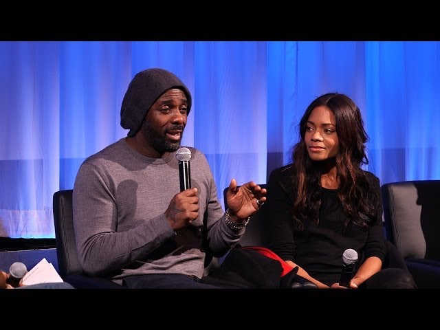
Clint Eastwood
From: YouTube <noreply@youtube.com>
Date: Tue, 26 Nov 2013 17:58:22 +0000
To: kenmccoypress<kenmccoypress@yahoo.com>
Subject: Oscars just uploaded a video
| |||||||||||||||||||||||||||||||||||||||||||


Monday, November 25, 2013
Fw: Oscars just uploaded a video
From: YouTube <noreply@youtube.com>
Date: Mon, 25 Nov 2013 21:23:12 +0000
To: kenmccoypress<kenmccoypress@yahoo.com>
Subject: Oscars just uploaded a video
| |||||||||||||||||||||||||||||||||||||||||||

Sunday, November 24, 2013
Fw: Breaking: PHOTOS: See the AMA All-Star Arrivals!
From: "People Daily" <people@people.chtah.net>
Date: Mon, 25 Nov 2013 02:15:55 -0000
To: <xipnek@aol.com>
ReplyTo: "People Daily" <support-b6qdscfb5rptqkarqp870a0ehv4gah@people.chtah.net>
Subject: Breaking: PHOTOS: See the AMA All-Star Arrivals!
| If you are having trouble viewing this email click here. | Add people@people.chtah.net to your address book |
UNSUBSCRIBE · PRIVACY POLICY · EMAIL OPT-OUTS Copyright © 2013 Time Inc. All rights reserved. Reproduction in whole or in part without permission is prohibited. | |||||||


| If you have any questions about your PEOPLE magazine subscription, please contact Subscriber Services. You may also mail inquiries to: PEOPLE Customer Service ATTENTION: PEOPLE Consumer Affairs 3000 University Center Drive Tampa, FL 33612-6408 |
Tweet from @TheWrap
@TheWrap: American Music Awards: Live-Streaming the Red Carpet (Video) #AMAs http://t.co/6gIrplftOu
Fw: It's Always Summer Somewhere! Tara Reid Proves Tanning Year-Round IS A Thing
------Original Message------
From: HuffPost Celebrity
To: Ken McCoy
Subject: It's Always Summer Somewhere! Tara Reid Proves Tanning Year-Round IS A Thing
Sent: Nov 24, 2013 1:05 PM
It's Always Summer Somewhere! Tara Reid Proves Tanning Year-Round IS A Thing CELEBRITY This Might Just Be The Most '90s Photo Ever Taken
Be right back, we're printing this out in poster size.
Hayden Panettiere Bares Her Back In A Cutout Dress
Tara Reid Takes Miami In A Bikini
GRAPHIC IMAGE: Food Network Host Slices Finger Open On Live TV
We're sorry but this makes us feel A LOT better about our own kitchen blunders.
Continue reading Miley Cyrus The Turkey Will Haunt Your Thanksgiving Dreams
Twerking, turking -- potato, potahto, right??
Continue reading
Friday, November 22, 2013
Fw: Oscars just uploaded a video
From: YouTube <noreply@youtube.com>
Date: Fri, 22 Nov 2013 17:31:01 +0000
To: kenmccoypress<kenmccoypress@yahoo.com>
Subject: Oscars just uploaded a video
| |||||||||||||||||||||||||||||||||||||||||||
Thursday, November 21, 2013
Fw: Oscars just uploaded a video
From: YouTube <noreply@youtube.com>
Date: Fri, 22 Nov 2013 00:34:00 +0000
To: kenmccoypress<kenmccoypress@yahoo.com>
Subject: Oscars just uploaded a video
| |||||||||||||||||||||||||||||||||||||||||||

Fw: Oscars just uploaded a video
From: YouTube <noreply@youtube.com>
Date: Thu, 21 Nov 2013 20:16:26 +0000
To: kenmccoypress<kenmccoypress@yahoo.com>
Subject: Oscars just uploaded a video
| |||||||||||||||||||||||||||||||||||||||||||
Wednesday, November 20, 2013
Fw: Oscars just uploaded a video
From: YouTube <noreply@youtube.com>
Date: Thu, 21 Nov 2013 00:44:45 +0000
To: kenmccoypress<kenmccoypress@yahoo.com>
Subject: Oscars just uploaded a video
| |||||||||||||||||||||||||||||||||||||||||||

Subscribe to:
Posts (Atom)